Chanel Cleeton Popular Books
Chanel Cleeton Biography & Facts
Reese's Book Club is a celebrity book sales club run by Reese Witherspoon under her media company Hello Sunshine. Since its founding in 2017, the club has gained a reputation for boosting the careers of female authors such as Delia Owens, Celeste Ng, and Megan Miranda.Hello Sunshine has been involved in the adaptation of several Reese's Book Club Picks into films and television series, including Little Fires Everywhere, Where the Crawdads Sing, and Daisy Jones and the Six. History Reese's Book Club was founded in 2017 and operates under Witherspoon's media company Hello Sunshine, led by Chief Executive Officer Sarah Harden. Harden was appointed to the position in 2018, after serving as interim CEO beginning in June 2017.Also in June 2017, Eleanor Oliphant is Completely Fine by Gail Honeyman became the first book selected as a Reese's Book Club Pick. Since then, the club has highlighted a Book Club Pick every month, reportedly chosen by Witherspoon.Reese's Book Club has gained a reputation for boosting the sales of its Book Club Picks. As of 2019, no Book Club Picks had sold fewer than 10,000 copies and novels selected as Book Club Picks reportedly outsell other fiction books by 700%.In August 2020, Reese's Book Club announced that it would being selecting a monthly young adult Book Club Pick, with the first YA selection being You Should See Me in a Crown by Leah Johnson. Hello Sunshine Adaptations Witherspoon's production company Hello Sunshine has optioned the film rights to several Book Club Picks, including Where the Crawdads Sing, Eleanor Oliphant is Completely Fine, Little Fires Everywhere, Daisy Jones and the Six, Tiny Beautiful Things, and The Last Thing He Told Me. Brand Partnerships In April 2022, Reese's Book Club partnered with furniture company Havenly to create a line of home decor called "Reading Room." Controversy Where the Crawdads Sing Reese's Book Club faced criticism in July 2019 after it was reported that Mark Owens, the ex-husband of Delia Owens, author of Reese's Book Club Pick Where the Crawdads Sing, was possibly connected to a murder that took place in Zambia in 1995. The Nightingale Reese's Book Club was the subject of controversy following the announcement of its March 2023 Book Club Pick The Nightingale by Kristin Hannah. In a video posted to the Reese's Book Club Instagram page, Witherspoon explained that the novel, which tells the story of two women in German-occupied France during World War II, was chosen in response to rising antisemitism. Some criticized this choice, noting that the novel does not prominently feature any Jewish characters and was not written by a Jewish author. Book Club Picks References. Discover the Chanel Cleeton popular books. Find the top 100 most popular Chanel Cleeton books.
Best Seller Chanel Cleeton Books of 2024
-
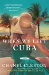
When We Left Cuba
Chanel CleetonInstant New York Times bestseller!In 1960s Florida, a young Cuban exile will risk her lifeand heartto take back her country in this exhilarating historical novel from the author of...
-
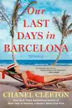
Our Last Days in Barcelona
Chanel CleetonAn NPR Best Book of 2022 “A master class in family and political drama, in starcrossed love stories and in capturing the enormity of what home is.”NPRWhen Isabel Perez trave...
-
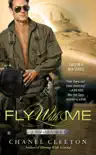
Fly With Me
Chanel CleetonFrom the author of Next Year in Havana comes the first Wild Aces Romance.U.S. Air Force fighter pilot Noah Millercall sign Burnloves nothing more than flying hard and fast. When he...
-
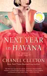
Next Year in Havana
Chanel CleetonA HELLO SUNSHINE x REESE WITHERSPOON BOOK CLUB PICK“A beautiful novel that's full of forbidden passions, family secrets and a lot of courage and sacrifice.”Reese WitherspoonAfter t...
-
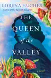
The Queen of the Valley
Lorena Hughes“An engrossing, suspenseful family saga.” Chanel Cleeton, New York Times bestselling author of Next Year in Havana on The Spanish Daughter Set amid Colombia’s unparalleled be...
-
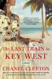
The Last Train to Key West
Chanel CleetonInstant New York Times bestsellerOne of Bustle’s Most Anticipated Books of Summer 2020 “The perfect riveting summer read!”BookBub In 1935 three women are forever chang...
-
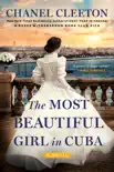
The Most Beautiful Girl in Cuba
Chanel CleetonNamed one of 2021’s Most Anticipated Historical Novels and Best Beach Reads by Entertainment Weekly ∙ Oprah Magazine ∙ Travel + Leisure ∙ BuzzFeed ∙ Parade ∙ PopSugar ∙ Bustle...
-
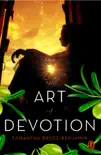
The Art of Devotion
Samantha Bruce-BenjaminIn the tradition of bestselling authors Ian McEwan and Anne Enright, Samantha BruceBenjamin’s brilliant and timeless debut unveils the dark side of human nature as four women share...
-
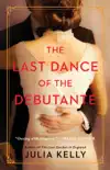
The Last Dance of the Debutante
Julia KellyIn this “glorious dance through the traditional glamour and suffocating expectations of a bygone era” (Genevieve Graham, USA TODAY bestselling author), a group of young women are s...
-
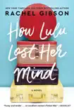
How Lulu Lost Her Mind
Rachel GibsonFrom the New York Times bestselling author of The Art of Running in Heels comes “a compassionate, poignant, often humorous story of the complicated relationship between a mother an...
-
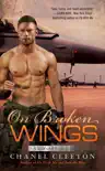
On Broken Wings
Chanel CleetonThe author of Into the Blue and Fly with Me returns with the third highflying Wild Aces romance...A year after losing her husband, Joker, the squadron commander of the Wild Aces, D...
-
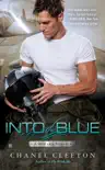
Into the Blue
Chanel CleetonFrom the author of Fly with Me comes the second romance in the Wild Aces series. Eric Jansencall sign Thorloves nothing more than pushing his F16 to the limit. Ret...
-
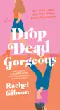
Drop Dead Gorgeous
Rachel GibsonThis “funny and touching” (Lauren Layne, New York Times bestselling author) fishoutofwater tale from New York Times bestselling author Rachel Gibson explores what happens when a sm...
-
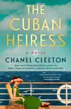
The Cuban Heiress
Chanel CleetonAn NPR Books We Love selection for 2023"An unforgettable read that should be at the top of every TBR list."NPRIn 1934, a luxury cruise becomes a fight for survival as two women’s p...
-
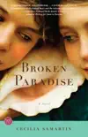
Broken Paradise
Cecilia SamartinIn Broken Paradise Cecilia Samartin offers heart wrenching insight into the tender balance between hope and grief that shapes the immigrant heart and exposes the struggles of every...
-
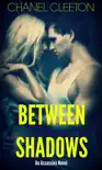
Between Shadows
Chanel CleetonA sexy new thriller about love and revenge from the author of the Capital Confessions and International School series… X lives by three rules: Show no weakness. Trust no one. ...
-
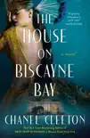
The House on Biscayne Bay
Chanel CleetonNamed an Anticipated Read of 2024 by Entertainment Weekly and a Best Historical Fiction novel of 2024 by BookBub.As death stalks a gothic mansion in Miami, the lives of two women i...
-
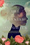
The Spanish Daughter
Lorena Hughes“An engrossing, suspenseful family saga filled with unpredictable twists and turns.” Chanel Cleeton, New York Times bestselling author of Next Year in Havana“With an equal mix of h...
